Flight Log
The Flight Log allows you to view all the flights recorded from the Remote ID Pro. The logging of a flight starts when a GPS-estimate is found by the Remote ID Pro.
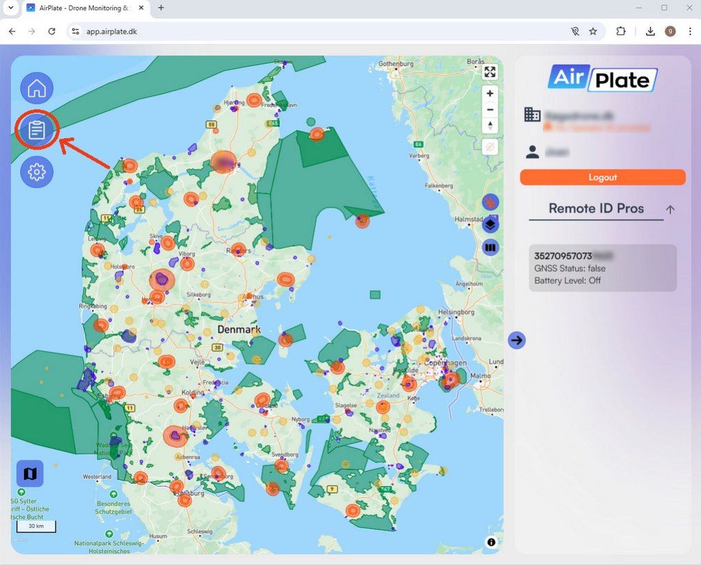
You access the Flight Log by clicking the highlighted icon in the image below. The Flight Log is only shown in the menu if you have a Remote ID registered to your profile.
Flight Log Table
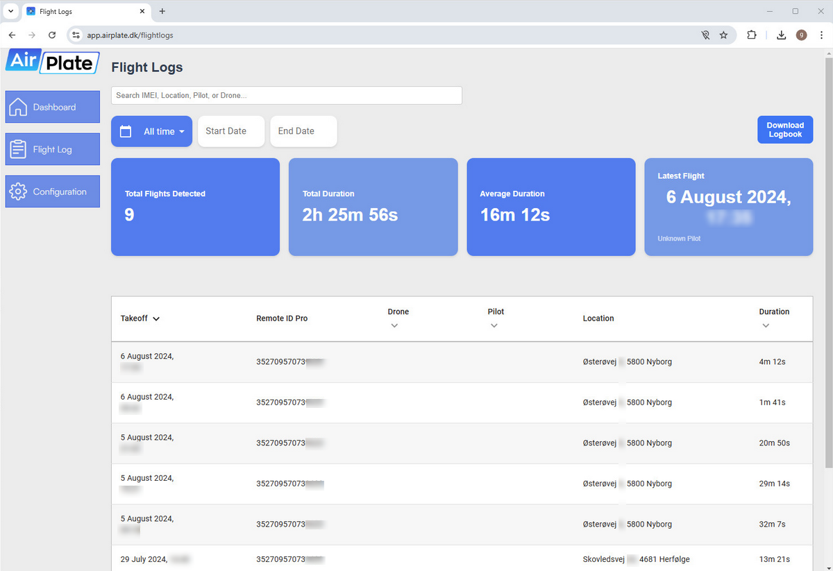
In the Flight Log, all recorded flights are displayed in a table, each row representing a flight. Select a flight to view flight path and more detailed information. The table contains the following columns:
- Take off date and time
- Remote ID Pro
- If a name have been assigned to the Remote ID Pro, the name will be displayed, otherwise, the serial number will be shown. Assigning a name to the Remote ID Pro can be done in the configuration page here.
- Pilot's name
- If a pilot have been assigned to a drone, the name of the pilot is displayed. Assigning a pilot to a drone can be done in the configuration page here.
- Drone's serial number
- If a drone is registered and assigned to a Remote ID Pro, it will be displayed in the flight log. Detailed instructions on how to register your drone can be found on the configuration page here.
- Starting location of the flight, which is the estimated address of the take off location.
- Duration of the flight.
Download Logbook
You can choose to download the logbook as a CSV file. The data will be organized in a table format, containing the following columns:
- Start date of the flight
- Stop date of the flight
- Airplate ID
- Airplate name
- Drone's serial number
- Pilot's name
- Starting location of the flight
- Maximum height reached
- Flight duration
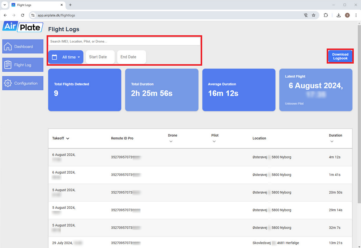
Note that you can specify which flights you want to download in the CSV file. This can be achieved through the search bar or the date range selector, both highlighted in the image below.
Detailed Flight Information
In the detailed flight information you can see the flight path of the Remote ID Pro plotted on a map along with the take off (Blue dot) and landing locations (Red dot). In addition, you can also see maximum altitude achieved, speed and total distance traveled. If a pilot have been assigned to the drone, the pilot's drone ID certificate will be displayed if it registered in the configuration page here.
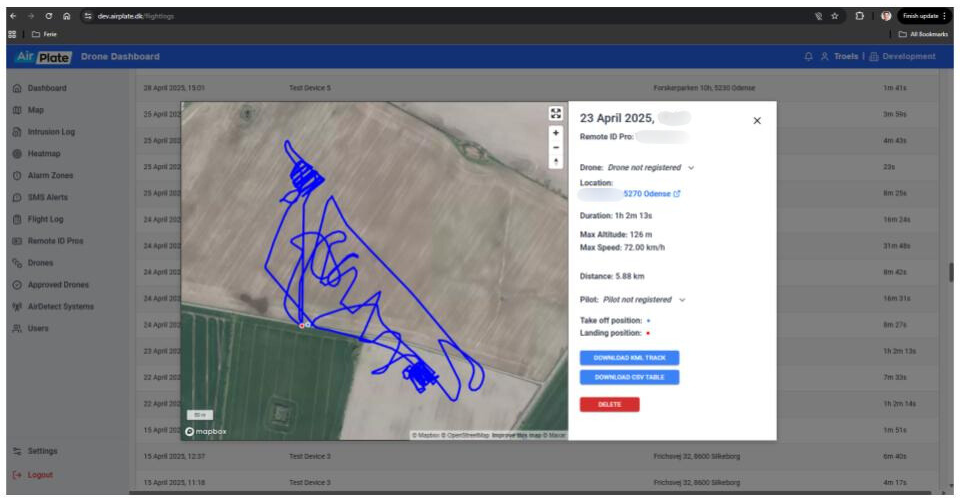
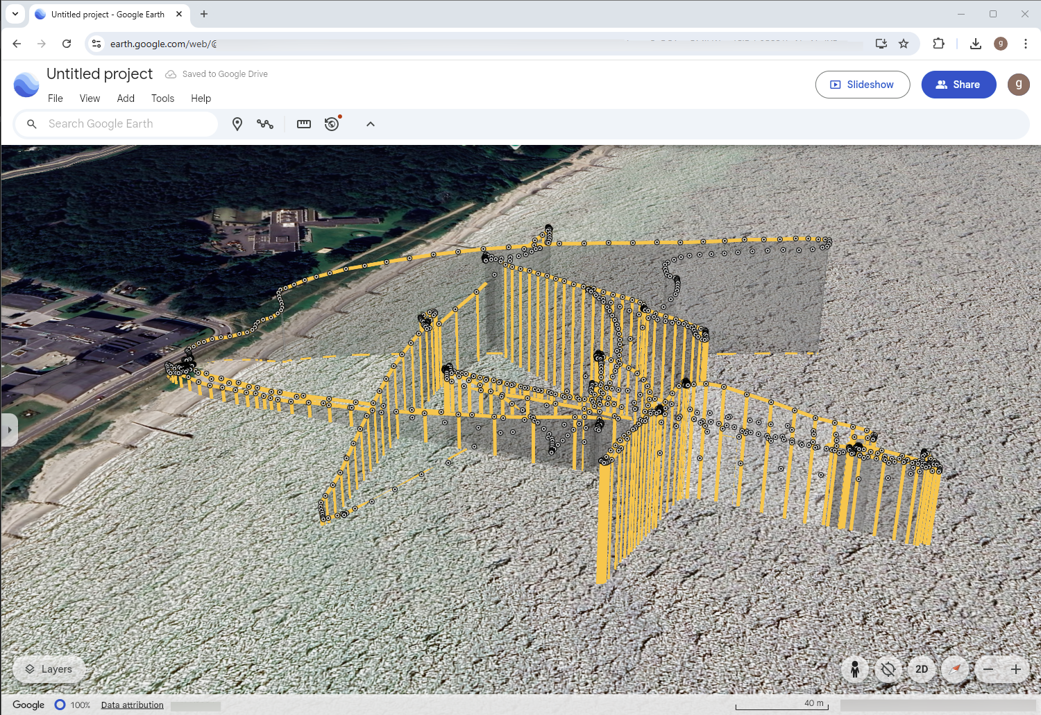
The flight path of the Remote ID Pro can be downloaded in a KML file, which can be imported into tools such as Google Earth. The file contains the positional data for each coordinate, including:
- Latitude
- Longitude
- Altitude
- Time stamp
You can also choose to delete a flight through the delete button. However, this can not be undone.
Flight path imported to Google Earth
By downloading the KML-file you can import it to Google Earth for more detailed viewing.